Anyone can now browse, download, re-image or edit through the collection of illustrations. Each illustration is taken from the massive British Library resources of 17th to 19th century books it has in the archive in London.
I had an hour of browsing and curated my own collection of interesting map images below.
Click an image and it will open the British Library collection in a new tab.
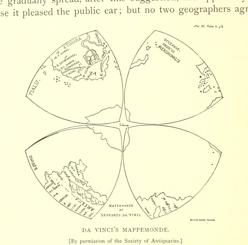
#1: Leonardo Da Vinci's World Map. Da Vinci produced this between 1513 and 1515 (exact date not known). This is an incredibly important map as it is a) the first to name 'America' on it, b) the earliest map showing the West coast of America unconnected to Asia.
Drawn on a strange construction of what are known as Da Vinci-Reuleaux triangles. This is one of the two maps that when placed side by side make up two halves of the globe as Da Vinci saw them - a lot different to our usual representation of the world on a flattened cylinder.
This style of map based on Reuleaux geometry inspired Cahill Butterfly projection maps in the early 20th century.
Image taken from page 84 of 'A larger history of the United States of America to the close of President Jackson's administration ... Illustrated, etc' published 1885
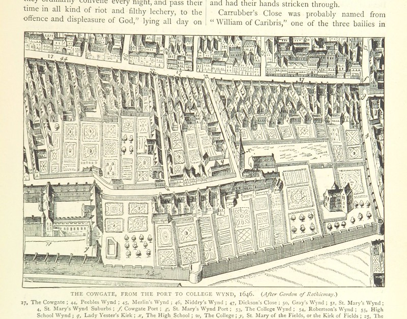
#2: A very nice illustrated Edinburgh map, still showing agriculture in the city centre!
Image taken from page 279 of 'Cassell's Old and New Edinburgh ... Illustrated, etc' published in 1880
#3: The Earth as imagined by the Greeks in the time of Homer (not Simpson, the other one!). Interesting to see how they got the Mediterranean pretty spot on in mapping terms.
Image taken from page 18 of '[The Countries of the World: being a popular description of the various continents, islands, rivers, seas, and peoples of the globe. [With plates.]]'
![Image taken from page 18 of '[The Countries of the World: being a popular description of the various continents, islands, rivers, seas, and peoples of the globe. [With plates.]]'](http://farm8.staticflickr.com/7446/11305850565_68864df1e6_c.jpg)
#4: A really detailed map of the Balkans - love the simple use of colour for internal political boundaries. Also note the European side of Turkey (Eastern Thrace) is called Rumilla - something I cannot find any links to on the web? Research for another day..
Image taken from page 159 of '[History of the Russian Empire from its foundation by Ruric the Pirate to the accession of the Emperor Alexander II ... With ... engravings.]'
![Image taken from page 159 of '[History of the Russian Empire from its foundation by Ruric the Pirate to the accession of the Emperor Alexander II ... With ... engravings.]'](http://farm8.staticflickr.com/7340/11131721366_93047fa03a_c.jpg)
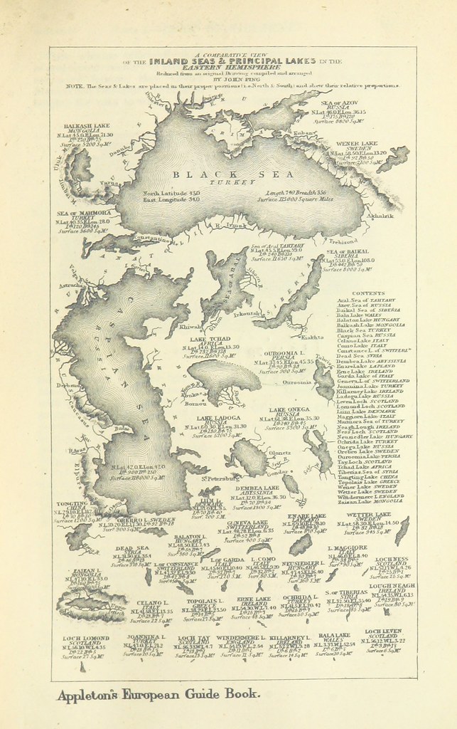
#5: An interesting collection of lakes and inland waters in Eastern Hemisphere (shame they didn't have the plate for the West included in the collection). Shows the truly massive scale of both the Black Sea and the Caspian Sea.
Image taken from page 101 of "[Appleton's European Guide Book illustrated. Containing ... maps, etc.]" published in 1879
I may put up a second blog post in a few days with other types of images - but I love maps so this was an obvious first choice.
There are so many interesting plates/scans in there that you really have to go and take a look yourself if you have any interest whatsoever in illustration or early graphic design.
Next year the British Library are going to launch a crowdsourcing ability or app so that anyone can go and look at the collection, and append notes to the diagrams/illustrations etc
Thank you British Library!